Volcanic activity is a powerful and fascinating phenomenon that can reshape landscapes and impact the environment. With recent geological activity stirring up concerns in various regions of the United States, understanding these eruptions and their implications is crucial. This article will delve into the current volcanic activities in the U.S., specifically focusing on the Ring of Fire and other notable locations.
Volcanic activity in Washington and Oregon
Stretching down the western coast of the United States, the Ring of Fire encompasses many active volcanoes, particularly in states like Washington and Oregon. These areas are not just geological hotspots; they are also rich in history and culture related to volcanic activity.
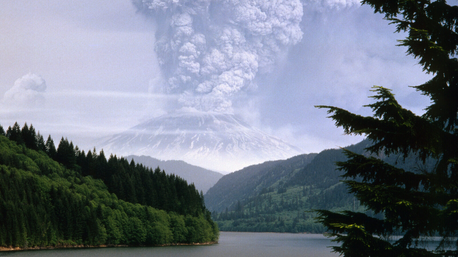
One of the most infamous volcanoes in this region is Mount St. Helens, which is known for the catastrophic eruption in 1980, marking it as one of the deadliest in U.S. history. However, the current focus is on Mount Rainier, located about 40 miles southeast of Tacoma. On July 8, 2025, it experienced a significant earthquake swarm, registering more than 700 tremors — a stark contrast to the usual nine per month.
The recorded seismic activity reached magnitudes of up to 2.4, creating interest and concern among geologists. While the tremors continued through mid-July, they were minor and occurred deep underground, meaning they posed no immediate danger to the surrounding communities.
In Oregon, approximately 300 miles offshore lies the Axial Seamount, recognized as the most active underwater volcano in the region. Its last eruption was in 2015, and recent activity has included increased seismic events and signs of magma buildup. Scientists are closely monitoring this underwater giant, as a potential eruption could have significant implications, although it remains a safe distance from the coast.
Understanding the geological significance of the Ring of Fire
The Ring of Fire is a horseshoe-shaped zone in the Pacific Ocean basin, notorious for its seismic and volcanic activity. This area is significant because:
- It contains approximately 75% of the world’s active and dormant volcanoes.
- It is home to about 90% of the world’s earthquakes.
- Its geological activity is primarily due to the movements of tectonic plates.
These tectonic plates are constantly shifting, leading to the formation of volcanoes and the occurrence of earthquakes. The interplay of these geological forces makes the Ring of Fire a focal point for scientific study and a subject of concern for residents in nearby areas.
Volcanic activity in Hawaii and what it all means
In contrast to the volcanoes along the mainland U.S., Hawaii’s volcanic formations are primarily the result of a mantle plume, which is a hot spot where magma rises from deep within the Earth. This unique geological setting has led to the formation of one of the world’s most active volcanoes, Kīlauea.
Kīlauea has been under an orange watch alert due to its frequent eruptions, with significant events happening almost weekly since December 2024. These eruptions have produced impressive lava flows and ash plumes, the most notable being a major event on May 25, 2025, that sent ash 1,000 feet into the atmosphere.
Despite its activity, Kīlauea, located about 200 miles from Honolulu, does not currently pose a direct threat to populated areas. However, the ongoing eruptions and their patterns are closely monitored by geologists.
What does this volcanic activity signify for the broader context of geological science? It highlights the unpredictable nature of volcanoes. According to USGS Earthquake Science Center seismologist Natalia Ruppert, while these eruptions can be concerning, the recent seismic events across the Ring of Fire are not necessarily interconnected. Volcanic activity can fluctuate, with periods of dormancy followed by bursts of seismic events.
The implications of increased volcanic activity
Increased volcanic activity can have various implications, not only for scientists but also for the communities living in proximity to these geological wonders. Some of the key implications include:
- Environmental Impact: Eruptions can lead to ashfall, affecting air quality and agriculture.
- Public Safety: Hazard assessments are crucial for preparing communities for potential eruptions.
- Scientific Research: Eruptions provide valuable data for understanding geological processes.
As scientists study these eruptions, they gain insights into the mechanisms that drive volcanic activity. This knowledge can help improve early warning systems and preparedness strategies for communities at risk.
Future monitoring and research efforts
The U.S. Geological Survey (USGS) plays a vital role in monitoring volcanic activity across the country. Continuous advancements in technology enable scientists to observe seismic activity and gather data more efficiently. Some of the methods employed include:
- Seismic monitoring stations to detect tremors and eruptions.
- Satellite imagery to observe ground deformation.
- Gas emission measurements to assess volcanic activity levels.
Efforts are also underway to enhance public awareness and preparedness in volcanic regions. Educational programs and community engagement initiatives are essential to ensure residents understand the risks and know how to respond in the event of an eruption.